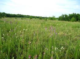
Tall grass on the Blackland Prairies provided inspiration to settle the area in the early 1800s.
In October 1963, Ambassador Fletcher Warren wrote a series of articles for the Wolfe City Sun entitled “A History of Northern Hunt County.” In it he described the land around the Wolfe City area and much of the rest of Hunt County; a land of fertile soil as evidenced by the tall grass prairies replete with water and timber sources from the numerous streams and small rivers rising throughout the county. The only thing missing to make the place perfect for earlier pioneers was an absence of tax collectors. A brief glimpse of the region will show that much of this area of Texas was somewhat an unclaimed region; hence few tax collectors.
Some of the earliest white settlers in all of Texas inhabited this area not far from the Red River. In 1816 Claiborne Wright moved his family from Carthage, Tennessee, to the Arkansas Territory in a keelboat. When they first arrived they settled near Pecan Point in what is today Red River County before moving to the north side of the Red River. By 1828 Wright settled permanently between Jonesborough and Pecan Point along with other early families. Skipper Steely of Paris in Lamar County has written an excellent book about his ancestors’ adventure, Six Month from Tennessee, available at the W. Walworth Harrison Public Library.
At the time of Wright’s initial arrival there was no definitive boundary between Spain and the United States following the Louisiana Purchase in 1803. In 1819 the United States and Spain agreed on the boundary, with the United States ceding all claims to Texas in favor of Florida. The southwestern boundary was to follow the Sabine River from the Gulf of Mexico to the thirty-second parallel where the line turned due north to the Red River, the actual eastern boundary of Texas today. But neither Spain nor the United States ran the line to the Red River and Southern speculators insisted that the Sabine River agreed to in the Louisiana Purchase was actually the Neches River farther west. Surveyors did not set the line until after the Battle at San Jacinto.
Northeast Texas was well settled but with little local government during the Spanish and Mexican regimes. That pleased the residents just fine. Few tax collectors were ideal. As more people arrived, they moved farther south and west of the Red River. The so-called second tier of north Texas counties such as Hunt, Hopkins, old Titus, and Cass were soon filling up with settlers by the Republic of Texas.
A woman posed a question last weekend that resulted in an Aha moment for me. Why would a widow move to northeast Texas when she knew it was part of Mexico? My answer startled me as much as it did her. This part of Texas was considered part of Miller County in Arkansas Territory until 1836 when Texas became a Republic and Arkansas became a state. The widow thought she was moving to Arkansas, not Mexico. Southern speculators insisted on several occasions that the Neches River was the eastern boundary of Texas leaving the area between that river and the Sabine a part of the United States. It was a very convenient appeal to new settlers even though it was completely phony.