
Over the years I have written about old roads in Texas and neighboring states. Without a doubt the oldest road to cross the Lone Star State is El Camino Real or as Anglos say, Old San Antonio Road (OSR). Spanish explorers forged this route from Florida to San Diego, the first trans-continental highway in North America. At that time, it crossed the northernmost points of the Spanish Empire.
In the 1830s and 1849s Anglos had taken control of what was Texas, from the Sabine River to the Red, then up to what would become the state of Montana, down to parts of New Mexico from the head of the Rio Grande to its mouth on the Gulf of Mexico. With all that land, Texans believed they needed connections to the U.S. Army across the Red River in Indian Territory. One of the main roads going from Austin to the mouth of Kiamichi River of the Territory made such a connection. Part of the road from the site of the Old Red Courthouse in Dallas to the Red River crossed the northwestern section of Hunt County near present day Webb Hill. Some settlers used that road to enter Texas, but the U. S. Army never came to the rescue of Texans.
Once Anglos became aware of the richness of Texas, roads or trails popped up all over the place. One of the earliest and most dangerous was Trammel’s Trace from St. Louis to Galveston. Gary L. Pinkerton, author of Trammel’s Trace: The First Road to Texas From the North walked most of the trace as it meandered through East Texas. His work is an exceptional piece of history, full of abandoned gold, outlaws, and rowdy inhabitants.
Jefferson, Texas, lies east of Trammel’s Trace. After an attempt to open Great Raft near Shreveport, a town grew on the banks of Big Cypress Bayou where it became a port of entry into the Republic of Texas and the State of Texas. The port brought supplies, such as whiskey to elegant fabrics and furnishings for prominent homes soon built in Northeast Texas. To deliver such goods waggoneers created a west-bound, rough road, dusty in dry weather, muddy when rains came, through forests, water ways, and open prairie. The road became known simply as the Jefferson Road that went all the way to some of the farthest settlements along the Red River, to Dallas and smaller villages. Jefferson Road became the major thoroughfare for the eastern section of the state before and during the Civil War.
By the 1870s residents clamored for railroads to replace those slow, rough roads. Cotton was bringing record prices, the soil in East Texas was perfect, all that was needed was a market. The decade saw railroads spreading out to places like New Orleans and Galveston where the fluffy boles (not white but dirty brown now) were shipped to textile factories in the East and in Europe. With the increase in rail traffic and the introduction of automobiles and trucks, farmers petitioned for roads, eventually those that were paved.
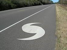
The period from 1910 through 1950s was a boom for roads and motor vehicles. General Dwight D. Eisenhower, as President, pushed for an intercontinental highway network, some with road ways wide enough for airplanes to land during the Cold War. Today the country is a woven mesh of Interstate highways. A new application for these thoroughfares is Hurricane Evacuation Routes.
On a road trip to Lafayette, Louisiana, last weekend I drove and drove and drove on wonderful roads. There was not much traffic, fewer trucks than on some interstates, and no commercial or residential buildings alongside the road. Along the route northward were signs stating, “Hurricane Evacuation Route”. This was Interstate 49 from Shreveport to Lafayette, quite a change since my husband and I made the same trip in 1974. Then the road twisted and turned to pass as many homes as were possible, it was narrow and the speed limit very slow.
I saw the same signs when leaving Beaumont a few years ago. During a storm, all lanes become one-way northbound to safety. Roads in Texas and every other section of our country has seen transportation change in much the same way. What’s next?